



Mappe dettagliate di tutti i paesi del mondo !!
- Ora con navigazione offline -
Detailed and easy to use offline maps. We have millions POI on our maps. Record your GPS tracks and bookmark your favorite locations.
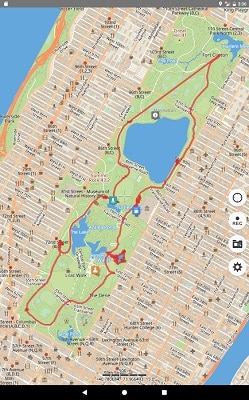
OFFLINE MAPS
• Amazingly detailed maps of all countries of the world.
• Based on open data from OpenStreetMap project. OSM is an open-source alternative to Mapquest, Google Maps and Waze.
• Updated monthly with improved data.
OFFLINE SEARCH
• Incredible fast - results appear instantly as you type.
• It works in variety of ways - by object name, category or even by GPS coordinates.
• It finds objects in multiple languages - this will make your searching much easier than ever.
BOOKMARKS
• Save favorite places on your map.
• Choose from lots of icons to assign to bookmarks.
GPS TRACKS
• Record your trips even when app is in background.
• Monitor your real-time speed, distance and time travelled, as well as altitude right on the map during the trip.
• Choose from 7 solid track colors or altitude and speed gradients.
IMPORT AND EXPORT
• It's easy to export your tracks, bookmarks or whole travel collection as KML or GPX file.
• User itinerary is organized to collections for easy access.
SMALL FEATURES
• MBTiles and sqlitedb offline raster maps support.
• One finger zooming.
• Trip computer with speed and altitude.
• Tracking mode.
• Coordinates and scale.
• Visible object set could be customized.
• 11 different map languages is supported.
• Map labels size could be changed. Large labels on maps is extremely useful while driving.
Aggiornata
18 mar 2025
Versione corrente
5.7.1
È necessario Android
5.0 e versioni successive
DOWNLOAD
FILESTORE
- NASCOSTO: SI
- Devi rispondere o ringraziare l’autore del messaggio per poter visualizzare la parte nascosta del testo
UPLOADY
- NASCOSTO: SI
- Devi rispondere o ringraziare l’autore del messaggio per poter visualizzare la parte nascosta del testo